HARMONIZED CODE: None
-
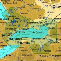
C-MAP M-NA-D934 4D Local Lake Ontario And Trent Severn
C-MAP - 4D CHARTS $207.00 Add to cartC-Map
Model: M-NA-D934-MS -
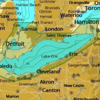
C-MAP M-NA-D933 4D Local Lake Erie And Lake St Clair
C-MAP - 4D CHARTS $207.00 Add to cartC-Map
Model: M-NA-D933-MS -
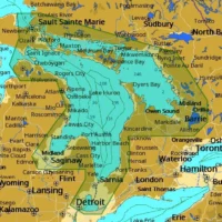
C-MAP M-NA-D932 4D Local Lake Huron And Georgian Bay
C-MAP - 4D CHARTS $207.00 Add to cartC-Map
Model: M-NA-D932-MS -
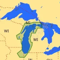
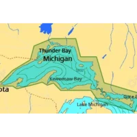
C-MAP M-NA-D931 4D Local Lake Michigan
C-MAP - 4D CHARTS $207.00 Add to cartC-Map
Model: M-NA-D931-MS -
C-MAP M-NA-D930 4D Local Lake Superior
C-MAP - 4D CHARTS $207.00 Add to cartC-Map
Model: M-NA-D930-MS -
C-Map MSD-NA-Y070 Insight Pro US Inland Lakes and Coastal
Cartography $99.99 Add to cartC-Map
Model: NA-Y070 -
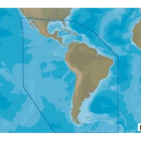
C-MAP Discover microSD South America and Caribbean
Cartography $129.00 Add to cartC-Map
Model: M-SA-Y038-MS -
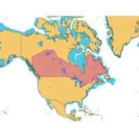
C-MAP Reveal Inland Canada Lakes
Cartography - C-MAP Precision $169.90 Add to cartC-Map
Model: M-NA-Y216-MS -
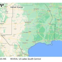
C-MAP Reveal Inland US Lakes South Central
Cartography - C-MAP Precision $179.00 Add to cartC-Map
Model: M-NA-Y215-MS -
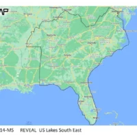
C-MAP Reveal Inland US Lakes South East
Cartography - C-MAP Precision $179.00 Add to cartC-Map
Model: M-NA-Y214-MS -
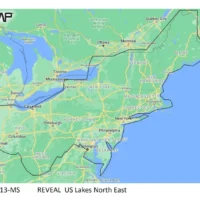
C-MAP Reveal Inland US Lakes North East
Cartography - C-MAP Precision $179.00 Add to cartC-Map
Model: M-NA-Y213-MS -
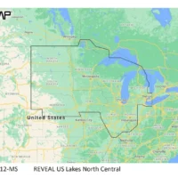
C-MAP Reveal Inland US Lakes North Central
Cartography - C-MAP Precision $179.00 Add to cartC-Map
Model: M-NA-Y212-MS -
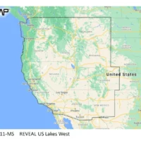
C-MAP Reveal Inland US Lakes West
Cartography - C-MAP Precision $179.00 Add to cartC-Map
Model: M-NA-Y211-MS -
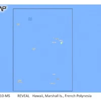
C-MAP Reveal Coastal Hawaii, Marshall Islands and French Polynesia
Cartography - C-MAP Precision $260.00 Add to cartC-Map
Model: M-NA-Y210-MS -
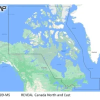
C-MAP Reveal Coastal Canada North and East
Cartography - C-MAP Precision $260.00 Add to cartC-Map
Model: M-NA-Y209-MS -
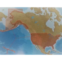
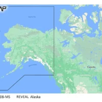
C-MAP Reveal Coastal Alaska
Cartography - C-MAP Precision $260.00 Add to cartC-Map
Model: M-NA-Y208-MS -
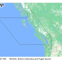
C-MAP Reveal Coastal British Columbia and Puget Sound
Cartography - C-MAP Precision $260.00 Add to cartC-Map
Model: M-NA-Y207-MS -
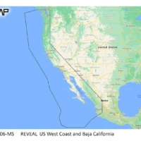
C-MAP Reveal Coastal US West Coast and Baja
Cartography - C-MAP Precision $260.00 Add to cartC-Map
Model: M-NA-Y206-MS -
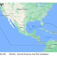
C-MAP Reveal Coastal Central America Caribbean
Cartography - C-MAP Precision $260.00 Add to cartC-Map
Model: M-NA-Y205-MS -
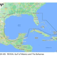
C-MAP Reveal Coastal Gulf of Mexico and Bahamas
Cartography - C-MAP Precision $260.00 Add to cartC-Map
Model: M-NA-Y204-MS