
Garmin GPSMAP® 1242xsv 12-inch Chartplotter/Sonar Combo Is All-in-1 Solution with Garmin Navionics+ coastal and inland water charts for the U.S. and Canada and GT52-TM Transducer – Remanufactured
Model: 010-N1741-60
- Large, bright 12″ screen with keypad interface and multifunction control knob
- Includes GT52-TM transducer for Garmin CHIRP sonar and CHIRP ClearVü™ and CHIRP SideVü™ scanning sonars
- Supports all-seeing live sonar, which includes LiveScope™ sonar (transducers sold separately)
- Preloaded Garmin Navionics+™ coastal charts and inland mapping feature Auto Guidance+™ technology (Auto Guidance+ is for planning purposes only and does not replace safe navigation operations); plus, there’s support for optional Garmin Navionics Vision+™ premium map content.
- Built-in wireless capabilities for Garmin mobile apps
- See RPMs, fuel flow, temperature, trim and more for up to four of your compatible Mercury® engines by using the SmartCraft® Connect gateway
- Supports the Garmin Marine Network; allows sharing of sonar, radar, maps, user data, and NMEA 2000® and NMEA 0183 network connectivity support, including autopilots, digital switching, weather, media, VHF, AIS and other sensors
- Includes Quickdraw Contours map drawing software
- Built-in Garmin SailAssist™ features include laylines, race features, set and drift, wind data and more
- Integrated ANT® connectivity support for use with compatible quatix® smartwatches, the gWind™ Wireless 2 transducer, GNX™ Wind marine instrument and remote controls (sold separately)
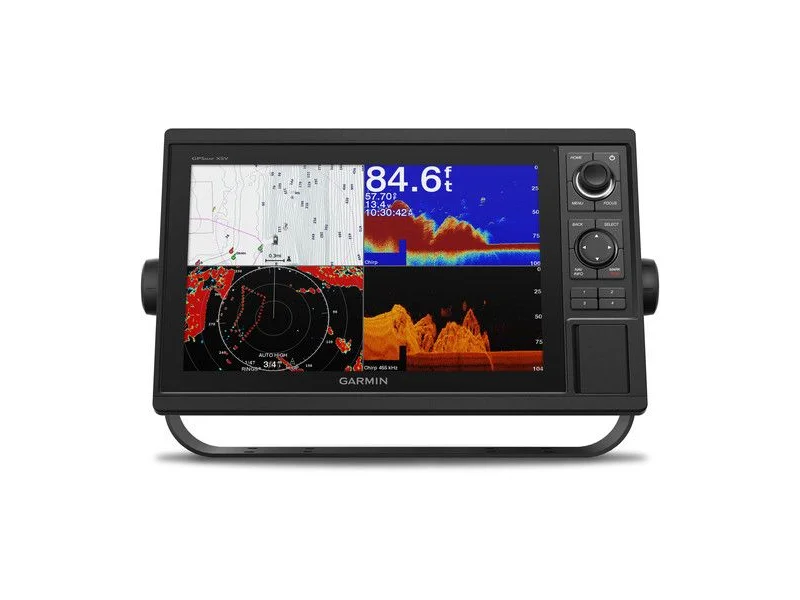
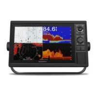
Experience an advanced all-in-one solution with our 12″ GPSMAP® 1242xsv keyed combo. It features a large, bright screen coupled with a keypad interface and multifunction control knob. A GT52-TM transducer is included for Garmin CHIRP sonar along with CHIRP ClearVü™ and CHIRP SideVü™ scanning sonars. There’s also support for Panoptix™ and LiveScope™ sonar products and a wide range of other transducers (sold separately). Preloaded Garmin Navionics+™ coastal charts and inland mapping feature Auto Guidance+™ technology (Auto Guidance+ is for planning purposes only and does not replace safe navigation operations). Plus, there’s support for optional Garmin Navionics Vision+™ premium map content. The combo also includes Quickdraw Contours software and the Quickdraw Community on our Garmin Connect™ online network. Use built-in Wi-Fi® technology to pair with the free ActiveCaptain® smartphone app for access to the OneChart™ feature, smart notifications, Garmin Quickdraw™ Community data and more. Garmin Marine Network support allows sharing of sonar, maps, user data, radar, IP cameras and live sonar among multiple units. Plus, there’s NMEA 2000® and NMEA 0183 network connectivity support, including autopilots, digital switching, weather, media, VHF, AIS and other sensors. These units also include integrated ANT® connectivity support for use with compatible quatix® smartwatches, the gWind™ Wireless 2 transducer, GNX™ Wind marine instrument and remote controls (sold separately). See RPMs, fuel flow, temperature, trim and more for up to four of your compatible Mercury® engines by using the SmartCraft® Connect gateway. “
Fast, responsive built-in 10 Hz GPS and GLONASS refreshes your position and heading 10 times each second to make your movement on the screen more fluid. It makes dropping up to 5,000 accurate waypoints — and finding your way back to them — quick and easy.
Instantly create personalized HD fishing maps on screen with 1’ contours. Tailor them to fit your needs. These are your maps — you own them. Keep the data to yourself, or share it with the Quickdraw Community on our Garmin Connect™ online network.
To help you gain a wind-maximizing competitive edge, your chartplotter features a prerace guidance page that shows your virtual starting line along with data fields showing laylines, time to burn before the start and a race timer that can be synchronized across all your networked Garmin GPS products. In addition, other supported sailing features include an enhanced wind rose, heading and course-over-ground lines, set and drift, true and apparent wind data and more.
If you have waypoints, tracks or frequently used routes stored on another manufacturer’s GPS product — or on a Garmin handheld device — it’s easy to transfer those items to your new Garmin chartplotter via industry-standard GPX software formatting.
What’s in the Box:
- GPSMAP 1242xsv chartplotter Garmin Navionics+ coastal and inland water charts for the U.S. and Canada – Remanufactured
- Power/data cable
- NMEA 2000 T-connector
- NMEA 2000 drop cable (2 m)
- Bail mount kit with knobs
- Flush mount kit with gasket
- Protective cover
- Trim piece snap covers
- Documentation
- GT52-TM transducer
WARNING: Cancer and Reproductive Harm – www.P65Warnings.ca.gov.